Dive into the diverse landscapes and thrilling challenges that await you on the routes of Apacheria Gravel. From rugged trails to scenic vistas, each route offers a unique and unforgettable journey through the Borderlands of Cochise County, AZ, and its surrounding areas. Whether you’re seeking an adrenaline-pumping adventure or a leisurely ride through nature’s wonders, our curated routes have something for every cyclist. Discover the magic of Apacheria Gravel and start planning your next epic ride today.
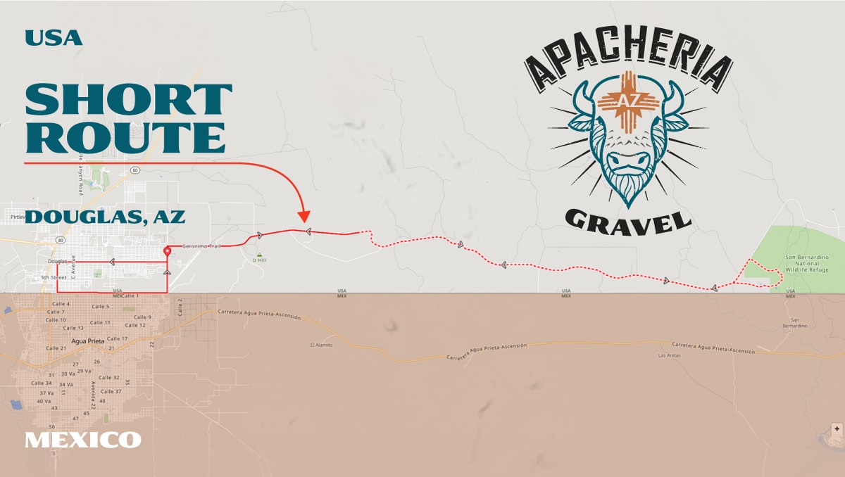
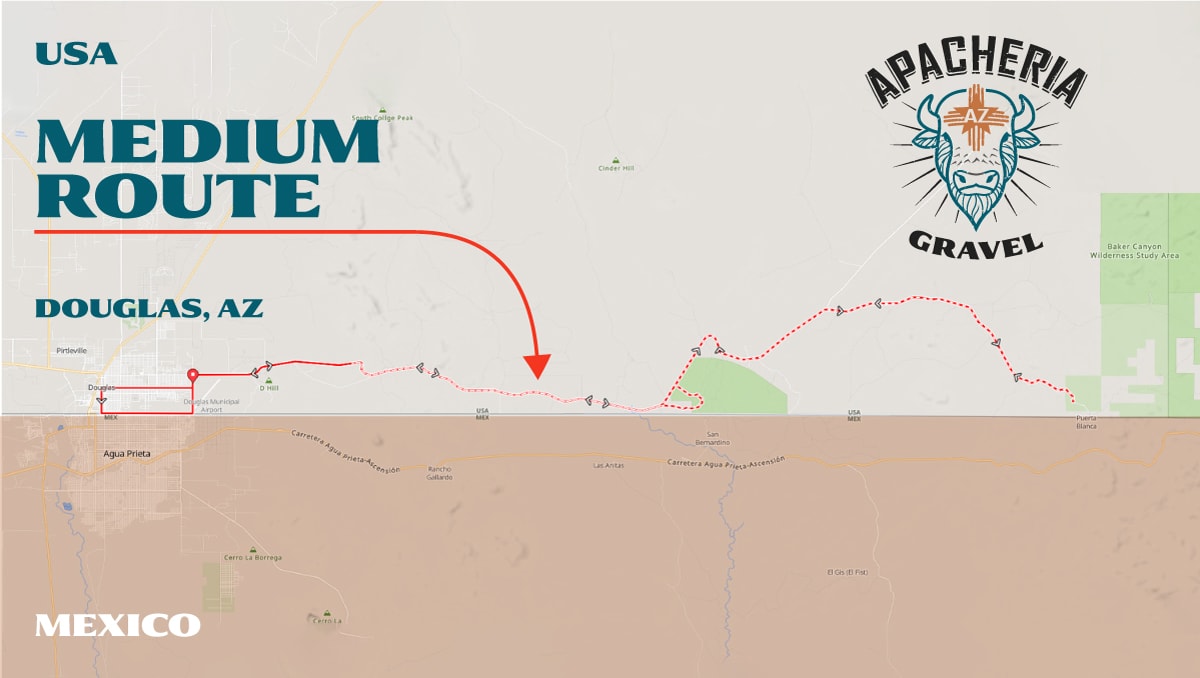
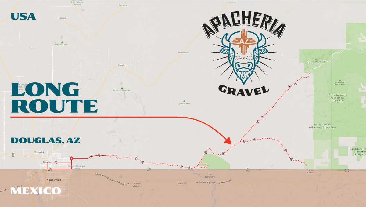
All three Apacheria Gravel routes (distances) will ride the Geronimo Trail east from Douglas, paralleling the international border wall between Douglas and the John Slaughter Ranch (JSR) Historical Landmark. As all participants approach the JSR, all three routes will head down the JSR Road – The JSR is the first aid station. All riders will exit the back side of the JSR and make their way through the San Bernardino National Wildlife Refuge and transition back towards and then on to the Geronimo Trail.

The SHORT COURSE participants will turn left on the Geronimo Trail and make their way back to Douglas and their final loop down 10th Street, left on G Avenue and a left on International Avenue riding directly adjacent to the International Border wall. This section of the Apacheria Gravel will be very unique and provide a great ending to an epic gravel adventure.


The Medium COURSES will turn right on the Geronimo Trail (after departing the SBNWR) and head towards the Guadalupe Canyon Road (GCR). This group will descend the GCR for 8.5 miles. At the bottom of the GCR there will be aid station 2 (two) – all riders will turn around and climb back up to the Geronimo Trail. This aid station essentially sits on the international border between the USA and Mexico. Very unique – not replicated in any other GRAVEL race in the US.
The MEDIUM COURSE participants will turn left and make their way back to the start / finish line at the Border Air Museum.
The MEDIUM COURSE riders will make their final loop down 10th Street, left on G Avenue and a left on International Avenue riding directly adjacent to the International Border wall.


The Long COURSES will turn right on the Geronimo Trail (after departing the SBNWR) and head towards the Guadalupe Canyon Road (GCR). This group will descend the GCR for 8.5 miles. At the bottom of the GCR there will be aid station 2 (two) – all riders will turn around and climb back up to the Geronimo Trail. This aid station essentially sits on the international border between the USA and Mexico. Very unique – not replicated in any other GRAVEL race in the US.
The LONG COURSE riders will turn right as they transition back on to the Geronimo Trail and head N.E. towards the third aid station and their turn around.
The LONG COURSE riders will make their final loop down 10th Street, left on G Avenue and a left on International Avenue riding directly adjacent to the International Border wall.

